Saturday Series 3
- When:
- Saturday 23 November 2024
- Where:
- Shire Brook Valley
- Category:
- Local
- Results:
- View Results
- Splits Analysis:
- View Splits Analysis
- Other:
- View Other
Details
Great to see so many of you made it to the event today. It is always tricky to know how much the weather will affect things. Hopefully you all enjoyed getting out there on some great courses planned by Lorraine and Markus Reuber. It looks like the urban bit recently mapped by Adam Conway is a great addition to the area and provides some good variation. Thnak you to all of our helpers, especially Dave Best who stepped in to check the controls as Colin is still recovering from an illness (hope you get better soon!). Of course also a big thank you to Sheffield Council for the use of the centre and Megan for openning up for us.
As ever the results and splits are available on the link above. Schools results will be updated tomorrow. If you spot any errors please
Amazingly only one item of lost property, a green hoody, let us know if it is yours.
The Schools League and Adults League have been refreshed with this years results.
Adults League Schools League Schools Individual Results
School Results
Primary
| School | Points | Runners | Counters | |
| 1 | Nethergreen | 392 | 8 | Fred Garratt (99) Evelyn Muir (98) Ruben Murray (98) Beatrice Bunting (97) |
| 2= | Abbeylane | 386 | 5 | Iamara Mikheeva (99) Saoirse Egan-Marchand (96) Elijah Middleton (96) Margarita Mikheeva (95) |
| 2= | Greystones | 386 | 5 | Poppy Mackie (100) WIll Fairbrother (100) Will Mackie (93) Jonah Bargh (93) |
| 4 | Westways | 384 | 6 | Riley Vines (99) Oscar Pearce (96) Fraser Shutt (95) Owen Hayward (94) |
| 5 | Hunters Bar | 287 | 3 | Esther French (100) Theo Anderson (98) Dylan Kennedy (89) |
| 6 | Ecclesall | 285 | 3 | Jules Hamilton (99) Billy Hart (94) Chris Hart (92) |
| 7 | Walkley | 197 | 2 | Isobel Little (99) Aphra Smout Bennett (98) |
| 8 | Dobcroft | 191 | 2 | Mattie Rothman (97) Ali Rothman (94) |
| 9 | Brunswick School | 187 | 2 | Bethany Kirkham (100) Daniel Kirkham (87) |
| 10 | Halfway | 186 | 2 | Harry Smart (95) William Smart (91) |
| 11= | Loxley | 100 | 1 | Austin Williams (100) |
| 11= | The Ellis Hemingfield | 100 | 1 | Oliver Smith (100) |
| 13 | Carterknowle | 99 | 1 | Joseph Trenell (99) |
| 14 | Chinley | 98 | 1 | Ged Waters (98) |
| 15 | Marlcliffe | 93 | 1 | Griffin Roberts (93) |
| 16 | St Marys CE | 90 | 1 | Odin Gann (90) |
Secondary
| School | Points | Runners | Counters | |
| 1 | King Edwards | 398 | 9 | Freddie Guy (100) Poppy Tedstill (100) Lucy Holt (99) Adrian Snowton (99) |
| 2 | High Storrs | 391 | 5 | Florrie Johnston (100) Jack Baxter (98) Jasper Davies (97) Alec Johnston (96) |
| 3= | Tapton | 296 | 3 | Samuel Froggatt (100) Oliver Maaranen (100) Cheung Kang Lee (96) |
| 3= | Silverdale | 296 | 3 | Zac Garratt (100) Alexander Cadman (99) Finn Mackie (97) |
| 5 | Mercia | 197 | 2 | Sophie Howsam (99) Esther Savage (98) |
| 6 | Hope Valley College | 100 | 1 | Hannah Chapman (100) |
| 7= | Hunters Bar | 98 | 1 | Alex French (98) |
| 7= | Bishop Pursglove | 98 | 1 | Paulina Cristos (98) |
| 9 | Abbeylane | 95 | 1 | Alexander Lilley (95) |
| 10= | Sheffield Park Academy | 94 | 1 | Barney Ireson (94) |
| 10= | Mundella | 94 | 1 | Sam Wood (94) |
| 12 | Birkdale | 93 | 1 | Toby Wade (93) |
Primary G4
| School | Points | Runners | Counters | |
| 1 | Nethergreen | 195 | 2 | Evelyn Muir (98) Beatrice Bunting (97) |
| 2 | Abbeylane | 191 | 2 | Saoirse Egan-Marchand (96) Margarita Mikheeva (95) |
| 3 | Greystones | 100 | 1 | Poppy Mackie (100) |
| 4 | Westways | 99 | 1 | Riley Vines (99) |
Primary B4
| School | Points | Runners | Counters | |
| 1 | Nethergreen | 291 | 3 | Fred Garratt (99) Thomas Salussolia (97) Timotei Anton (95) |
| 2 | Hunters Bar | 187 | 2 | Theo Anderson (98) Dylan Kennedy (89) |
| 3 | Westways | 174 | 2 | Frank Tedstill (88) Athelen Hayward (86) |
| 4 | The Ellis Hemingfield | 100 | 1 | Oliver Smith (100) |
| 5 | Abbeylane | 96 | 1 | Elijah Middleton (96) |
| 6 | Dobcroft | 94 | 1 | Ali Rothman (94) |
| 7 | Marlcliffe | 93 | 1 | Griffin Roberts (93) |
| 8 | Ecclesall | 92 | 1 | Chris Hart (92) |
| 9 | Halfway | 91 | 1 | William Smart (91) |
| 10 | St Marys CE | 90 | 1 | Odin Gann (90) |
| 11 | Brunswick School | 87 | 1 | Daniel Kirkham (87) |
Primary G5
| School | Points | Runners | Counters | |
| 1 | Brunswick School | 100 | 1 | Bethany Kirkham (100) |
| 2 | Abbeylane | 99 | 1 | Iamara Mikheeva (99) |
Primary B5
| School | Points | Runners | Counters | |
| 1 | Ecclesall | 193 | 2 | Jules Hamilton (99) Billy Hart (94) |
| 2 | Westways | 191 | 2 | Oscar Pearce (96) Fraser Shutt (95) |
| 3 | Loxley | 100 | 1 | Austin Williams (100) |
| 4 | Nethergreen | 98 | 1 | Ruben Murray (98) |
| 5 | Dobcroft | 97 | 1 | Mattie Rothman (97) |
| 6 | Greystones | 93 | 1 | Will Mackie (93) |
| 7 | Abbeylane | 92 | 1 | ALBERT EGAN-MARCHAND (92) |
Primary G6
| School | Points | Runners | Counters | |
| 1 | Walkley | 197 | 2 | Isobel Little (99) Aphra Smout Bennett (98) |
| 2 | Hunters Bar | 100 | 1 | Esther French (100) |
Primary B6
| School | Points | Runners | Counters | |
| 1 | Greystones | 285 | 3 | WIll Fairbrother (100) Jonah Bargh (93) Reuben Davies (92) |
| 2 | Nethergreen | 193 | 2 | Joseph Judge (97) Rafe Cadman (96) |
| 3 | Carterknowle | 99 | 1 | Joseph Trenell (99) |
| 4 | Chinley | 98 | 1 | Ged Waters (98) |
| 5 | Halfway | 95 | 1 | Harry Smart (95) |
| 6 | Westways | 94 | 1 | Owen Hayward (94) |
Secondary G7
| School | Points | Runners | Counters | |
| 1 | King Edwards | 292 | 5 | Lucy Holt (99) Emily Davison (97) Siri Watson (96) |
| 2 | High Storrs | 100 | 1 | Florrie Johnston (100) |
| 3 | Mercia | 98 | 1 | Esther Savage (98) |
Secondary B7
| School | Points | Runners | Counters | |
| 1 | Silverdale | 197 | 2 | Zac Garratt (100) Finn Mackie (97) |
| 2 | High Storrs | 189 | 2 | Alec Johnston (96) Toby Allison (93) |
| 3 | King Edwards | 99 | 1 | Adrian Snowton (99) |
| 4 | Hunters Bar | 98 | 1 | Alex French (98) |
| 5 | Abbeylane | 95 | 1 | Alexander Lilley (95) |
| 6 | Mundella | 94 | 1 | Sam Wood (94) |
Secondary G8/9
| School | Points | Runners | Counters | |
| 1 | Hope Valley College | 100 | 1 | Hannah Chapman (100) |
| 2 | Mercia | 99 | 1 | Sophie Howsam (99) |
| 3 | Bishop Pursglove | 98 | 1 | Paulina Cristos (98) |
Secondary B8/9
| School | Points | Runners | Counters | |
| 1= | King Edwards | 195 | 2 | Freddie Guy (100) Edan Hayward (95) |
| 1= | High Storrs | 195 | 2 | Jack Baxter (98) Jasper Davies (97) |
| 3 | Silverdale | 99 | 1 | Alexander Cadman (99) |
| 4 | Tapton | 96 | 1 | Cheung Kang Lee (96) |
| 5 | Sheffield Park Academy | 94 | 1 | Barney Ireson (94) |
| 6 | Birkdale | 93 | 1 | Toby Wade (93) |
Secondary G10/11
| School | Points | Runners | Counters | |
| 1 | King Edwards | 100 | 1 | Poppy Tedstill (100) |
Secondary B10/11
| School | Points | Runners | Counters | |
| 1 | Tapton | 100 | 1 | Samuel Froggatt (100) |
Secondary G12/13
| School | Points | Runners | Counters |
Secondary B12/13
| School | Points | Runners | Counters | |
| 1 | Tapton | 100 | 1 | Oliver Maaranen (100) |
Information
Come orienteering and explore the lovely Shirebrook Nature reserve in the South East of Sheffield. This is the 3rd race in the Saturday Series of events aimed at introducing adult and junior newcomers to orienteering and includes the very popular SFSS schools league. There are 6 different courses to choose from catering for young children, runners, newcomers and experienced orienteers. The map has been newly extended this year to include a small urban area adjacent to the park.

Schools Event
Running alongside the public event is the first event in the Sheffield Federation of School Sports (SFSS) Orienteering League for both Primary and Secondary pupils. Entry to the schools event is free if your school is a member of the SFSS. Information about the SFSS Orienteering League is here. The league is also open to home schooled pupils and those out schools outside Sheffield. It is not necessary for a teacher to be present from the school and you don't need to register in advance.
If you ran last year and have changed schools then you can still use the same Id number but you will need to let us know the name of your new school.
Adults' League
There is also a league for adults. As for the schools' league, your best 5 results count. Run which ever course you feel is most appropriate for you and we will incoporate your score into the league!
Timings
Registration and starts open at 12.30pm. You can start any time from 12.30pm to 3pm on white, yellow and orange. Last start for light green, green and blue is 2.30pm. All courses close at 3.30pm so make sure you start early if you think you might be a long time.
Costs
Adults £5, British Orienteering / SYO members £4
Children / Students £2 (Free for the first run if you are in Y3 or above and your schools is in the SFSS)
Any additional courses will cost £2
If you would like to go around in a group you pay for one entry, plus £1 for each extra map. SI card hire is free.
Entries
All courses are entry on the day. You just have to turn up, pick a course and fill in an entry form. There will be people on hand to help you if you have any questions.
If you ran one of the schools events last year then you should have completed an entry form and been given a number. With the number we are able to add you into the results system much quicker.
Volunteers
We need plenty of helpers to allow this event to go ahead. No experience is necessary. Please
Travel and parking
Parking is available in the public car park by the visitor's centre. Nearest postcode: S13 7BP. What3words: curving.finely.little (car park entrance).
Take the A57 towards Worksop from the Parkway and at the first big island take the first left, B6064 towards Woodhouse. Immediately after the roundabout, take the first right into Stone Lane. The car park is on the right. Drive carefully as you will meet people walking along the road. The car park has a height barrier which is 1.8 metres.
If getting there by public transport it is about 20 minutes by bus from the centre of Sheffield, there are several options use the Yorkshire Travel Planner to get to Coisley Hill from where it is a 5 minute walk down Stone Lane.
Terrain
Shire Brook Valley reserve is mostly wooded, with open areas and a good path network. Longer courses will also visit an intricate housing estate adjacent to the nature reserve.
Map

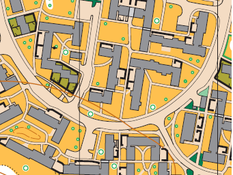
Forest map (ISOM at 7500) updates by Adam Conway and Ian Cooper 2024.
Shirebrook urban map (ISSprOM at 4000) by Adam Conway and Ian Cooper 2024.
Longer courses will have a double sided map - urban one side, forest the other.
Courses
See below for details on the courses on offer. Course lengths are indicative and may well change subject to final planning and controlling.
White, Yellow and Orange all stay within the Shirebrook Valley.
Light Green, Green and Blue visit the urban area to the north of the valley and approximately 2/3 of these courses is urban and 1/3 woodland. The woodland part of these courses avoids the dense vegetation of the nature reserve and have been planned to allow competitors to run whilst still offering navigational challenge. Note: course length is optimal distance. The Blue has several butterfly loops in the urban area in order to allow competitors to enjoy this complex little area to the full.
| Course | School Years | Distance | Technical Level | Who is it for? |
| White |
Y3/4 Y5 |
1.2km |
1 |
The easiest course and a great place for children to start. The course is entirely on paths and each time you have to make a decision - which path to take, there will be a control point. |
| Yellow | Y6,7 | 1.8km |
2 |
The next step up and a good place for teenagers etc. to start. The course will use paths but also other line features - Fences, streams etc. |
| Orange | Y8,9 |
2.5km |
3 |
Harder still, the Orange course introduces:
Those doing either of the Orange courses need to be able to judge distances, orientate the map using surrounding features and a compass, use attack points and be bold enough to venture off paths for up to 30 metres |
| Light Green |
Y10, 11 |
4.3km |
4 |
Ideal for improvers or confident adult beginners. The navigation difficulty increases - you will be using simple contours and point features. There's often a catching feature beyond the control to stop you going to far wrong. |
| Green | G12, 13 |
|
5 | As technically difficult as the area will allow. |
|
Blue |
B12, 13 |
|
5 | As per the green course but further in distance. |
Officials
Organiser Pauline Tryner. pauline'at'southyorkshireorienteers.org.uk
Planners Lorraine & Markus Reuber
Controller Colin Best
Safety & risk
A comprehensive risk assessment will have been carried out by the organiser, but participants take part at their own risk and are responsible for their own safety during the event. If a competitor has a pre-existing medical condition that they think should be declared, please complete a medical form at enquiries. The sealed envelope will only be opened in an emergency.
Photography
SYO has an agreed policy on the taking of photographs at events, based on national guidance. This provides a sensible balance between the benefits and risks associated with the taking and use of images. If you are unsure about acceptable practice, please speak to the event organiser. Read our photography policy.
Privacy
When entering our events your personal details (name, gender, age class & club) will appear in the results section of this website. Read our privacy policy to see how we look after your personal data.
Venue
Shire Brook Valley reserve is mostly wooded, with open areas and a good path network.
Sheffield Parks and Woodlands website says "Situated in South East Sheffield, the Shire Brook Valley contains over 100 hectares of land protected for Nature Conservation and recreation. The Reserve is open to the public all year round. Local Nature Reserve status was gained for the valley in 1999". "The area was once a hive of mining and industrial activity, with evidence of waterwheels dating back to Tudor times." The Shire Brook Valley Visitor Centre at the end of Stone Lane is our usual base. The reserve extends south of the A57 and contains Birley Spa Victorian Bathhouse.
Map History
2016 - Charles Hird - Survey & Cartography
2017 - Peel Land Surveys - Extended to include all the reserve to the North of the A57.