Evening event
- When:
- Wednesday 5 June 2024
- Where:
- Scholes Coppice
- Category:
- Local
- Results:
- View Results
- Splits Analysis:
- View Splits Analysis
Details
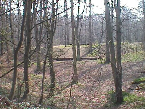
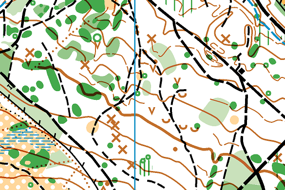
Hope you all enjoyed your run around Scholes Coppice this eventing. As you may have seen from the information on the map it has been many years since we last used the area for orienteering, with a partial remap by Simon and Adam Bradbury in 2011. Ian Cooper has now produced a great map for us to run on. I think it is great addition to SYO's areas although vegetation growth in the last few weeks has made it less runable, late April/early May would make much more of the area accessible. Results and splits are available on the link above.
Always great to have an indoor(ish) space and the Kinberworth Park were great hosts, thank you to them and if anyone would like to leave a review I'm sure they would appreciate it.https://www.helpraisethebar.co.uk/
Thanks to Euan for planning courses, it was good of him to show us that even elite orienteers can sometimes put a control slightly in the wrong place.. Thank you also to the rest of our helpers, you were a small but efficient band.
Information
Scholes Coppice is a brand new area to orienteering consisting of ancient woodland and open common land. The interesting contour detail will provide sufficient challenge to the experienced orienteer, while the good path network caters well to newcomers. There are courses for families, runners and those who'd prefer to walk & chat! We'll have our friendly volunteers on hand to tell you what to do. All welcome!

How to enter
Entries are now open on the SYO Entry System and close on Tuesday 4th June Please enter in advance.
Costs
£6 adults (£5 members), £3 juniors & students.
Pairs / family groups pay for one entry, extra map £1. Dibber hire free.
Parking
Parking in the Kimberworth Park pub car park, Oaks Lane, Rotherham, S61 3AX. What3words: finely.oasis.drums (entrance to car park).
Assembly
Outside the Kimberworth Park pub. Toilets and refreshments available. Menu available here. Last orders for food 7.30pm.
Please
Start / Finish
Start approx 200m walk. Finish in woods opposite pub. Please take care crossing a minor roads to / from the start & finish. Under 12s must be accompanied by an adult.
Timings
Starts 5.30pm to 6.45pm. Courses close 7.45pm promptly. If you think you might take a long time, please come early. If you have not finished your course by 7.45pm you must give up and report to the finish.
Courses
Yellow - easy navigation - 1.8km. Ideal for younger juniors and families.
Orange - medium navigation - 2.6km. A good place for adult beginners to start or families with older children.
Short Green - hard navigation - 2.7km.
Green - hard navigation - 4.3km.
Blue - hard navigation - 6.0km.
Please note: Distances are based on the straight line route measured between controls. You will run much further. Distances may change slightly after final checks.
Electronic timing with dibbers will be used. Controls will be SIAC enabled.
Map & Terrain

Scale 1:10000, 5m contours. ISOM 2017-2. Mapped by Ian Cooper 2024
Full leg cover is required on short green, green and blue courses.
Volunteers
As normal, we need a couple of helpers on start and some control collectors.
If you can help, please
Event Officials
Planner - Euan Tryner
Organiser - Pauline Tryner - pauline'at'southyorkshireorienteers.org.uk
Safety & risk
A comprehensive risk assessment will have been carried out by the organiser, but participants take part at their own risk and are responsible for their own safety during the event. If a competitor has a pre-existing medical condition that they think should be declared, please complete a medical form at enquiries. The sealed envelope will only be opened in an emergency.
Photography
SYO has an agreed policy on the taking of photographs at events, based on national guidance. This provides a sensible balance between the benefits and risks associated with the taking and use of images. If you are unsure about acceptable practice, please speak to the event organiser. Read our photography policy.
Privacy
When entering our events your personal details (name, gender, age class & club) will appear in the results section of this website. Read our privacy policy to see how we look after your personal data.
Venue
The Scholes Coppice map covers a number of areas of woodland, including Shepherd's and Bray Plantations, around Scholes village, which is just NW of Rotherham. Caesar's Camp, an iron-age hill fort, is in Scholes Coppice. There are some unusual names on the OS map; our map includes Handkerchief Piece but doesn't quite extend north to include Dog Kennel Pond.
