Night event
- When:
- Wednesday 7 November 2018, 17:45 - 18:45
- Where:
- Burbage Mines
- Category:
- Local
- Results:
- View Results
- Splits Analysis:
- View Splits Analysis
Details
Results & Maps
Thanks to everyone who came along this evening, a decent turnout despite the rain earlier in the day. Thankfully very different conditions to 2 years ago, when there was heavy snow overnight burying the controls that had been left out!
Results and Winsplits can be seen via the links above. Uploaded 22:15 7/11. Any issues, please
Think most seemed to enjoy the courses - was good to hear people were helping each other out there, particularly with some Night-O first timers out there who coped extremely well. Sorry to those on the Pitch Black, I agree the heather was a bit deep, but saved on doing another loop of the area; hope you enjoyed the added mental challenge of the loops!

Too many different versions of the map to upload to routegadget, but a pdf of each course can be found in this folder - I know a few were asking about other courses, spare maps etc.
And finally thanks to my parents for their help in putting out the tapes and controls... and for collecting them back in tomorrow morning!
A night event at Burbage Mines offering micro orienteering in a complex area of mine workings. Alongside courses for experienced orienteers, there is a course for newcomers so if you've never done night orienteering, this is an ideal opportunity!

Please enter in advance by
Parking
In layby opposite Lady Canning’s Plantation, 1km west of Ringinglow. Parking is limited, please car share if possible. Nearest Postcode – S11 7TT. Grid Ref. - SK278834. Location on Street Map
Timings
Registration in car at layby: 17:45-18.45
Start 350m walk away, 18:00 – 19:00
Courses close promptly at 19:45.
Finish: Adjacent to the start, download back at layby.
Costs
Adults £5 (Members £4)
Juniors / Students £3
Pairs welcome - you just pay for 1 entry.
Map
Scale 1:2500, 2.5m Contours, A4 size.
Ochre course - a map specific to this course, which includes many more paths. Where competitors should follow a taped route (max. 50m in length) of red/white streamers on stakes, it will be marked on the map as follows:
The taped route will be marked by an underprinted purple/pink line. The line between controls will be bent to the start and end of the taped route. This line will be cut over the taped route. There are 4 taped routes on Ochre only (other competitors should ignore this taping)

Pitch Black Course - this has a slightly extended main map, and hence has a scale of 1:3000 (a bit zoomed out). The small 'loop' extracts will be at a more 'zoomed in' scale of 1:2000. See the table below for details of the course.
Competitors will be reminded of these details on the night.
Courses (lengths subject to final planning):
Burbage Mines is a heavily contoured area, so climb will vary considerably depending on routechoice. As a rough guide, on the straight line route, you can expect to do ~25m climb per km (ish!)
With this being a night event, thought we'd go a shade darker for the course colours...
| Course | Length | Technical Level | Description | |
| Ochre |
1.6km (See note*) |
2-3 |
Following line features and aimed specifically at juniors and adults who are new to night orienteering. This is a great intro to Night O, with the course following paths, often in 'linear' contours (such as gullies), and taped sections where routes are vague. Inexperienced juniors must be shadowed by an adult. Controls (at least on the Ochre course, if not all) will have a reflective band attached to the stake, allowing them to be spotted through the darkness more easily! *There is the option of cutting the course short (between controls 7 to 17) which reduces the length to 900m. This is flexible - gauge once out there if you wish to do the middle loop of the course. |
|
| Jade | 1.5km | 5 | The shortest of the technically difficult courses. Doesn't venture to the extremes of the area, meaning you are always relatively close to the Finish. | |
| Navy |
2.2km |
5 |
Further than the Jade, allowing competitors to visit all of the area to the West. |
|
| Pitch Black | 3.3km | 5 |
Further still, but tries to limit the amount of criss-crossing and deja vu-ing. I have extended the map slightly to the East, incorporating a few new contour features, expanding the area (note different scale - above). Modelled on a club's training night I went to in the summer in Stockholm, this course will consist of 2 distinct parts, both on separate maps:
When I did this type of course in Sweden it was on a much larger area, but the basic principles of simplifying & planning on the long legs, changing scale, and then possibly slowing down & concentrating on the shorter legs are still valid, particularly on such a heavily contoured area as Burbage mines. Should be a decent challenge... oh, and it's at night! There'll be an example map around at registration/the start so you can be clear on it before you go off. If you particularly want a standard longer course, you can always do the Jade and Navy back-to-back. |
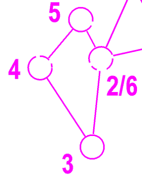
Merged onto one map, a loop would look something like this:
|
SportIdent Punching will be used.
Additional safety info
Burbage Moor is very exposed, and so if wet and/or windy is very chilly. Therefore whistles, headtorches & backup torches are compulsory, and cagoules are advised in the event of bad weather.
There is a main quarry in the centre of the area, with 2 sections of large crags which have large rocky, waterfilled depressions at their base. At the top of these crags there will be continuous hazard (black and yellow) taping to alert you of the nearby edge.
The Ochre course is planned to avoid these edges as much as possible, entering and exiting the quarry from the 'ground floor' Eastern side. The TD5 courses may encouter these crags on the courses. They are not to be crossed - please observe the OOB - but competitors can cross between the 2 lines of crags in the gap shown below. Legs over these features will be broken on the map.
In addition to this, there are smaller crags and areas of scree on the area - please be careful of these if you encouter them.

Officials
Organiser: Jacky Dakin
Post Event Social
Please join us from 6.45pm for food and / or drinks in the Norfolk Arms. Just order from the main menu at your convenience.
Safety & risk
A comprehensive risk assessment will have been carried out by the organiser, but participants take part at their own risk and are responsible for their own safety during the event. If a competitor has a pre-existing medical condition that they think should be declared, please complete a medical form at enquiries. The sealed envelope will only be opened in an emergency.
Photography
SYO has an agreed policy on the taking of photographs at events, based on national guidance. This provides a sensible balance between the benefits and risks associated with the taking and use of images. If you are unsure about acceptable practice, please speak to the event organiser. Read our photography policy.
Privacy
When entering our events your personal details (name, gender, age class & club) will appear in the results section of this website. Read our privacy policy to see how we look after your personal data.
Venue
Burbage Mines are on the north side of the road from Ringinglow to Hathersage, labelled on the 1:25000 Ordnance Survey map as "Brown Edge Quarries (disused)". They are included on the Burbage map, but in 2008 Marcus Pinker drew a new map at 1:2500 with 2.5m contours. He called the map Burbage Mines and the name stuck.
It is a small area of workings for sandstone roofing flags (colloquially "slates"). In the 1960s the council wanted to use it for a landfill site; luckily for us CPRE successfully opposed this plan. The old workings provide a wealth of contour detail and although much of it is a bit physical (heather and tussock around the quarries, bracken and marsh surrounding), it offers great orienteering.