Regional Urban Event
- When:
- Sunday 3 September 2017
- Where:
- Sheffield City South-West
- Category:
- Regional
- Results:
- View Results
- RouteGadget:
- View RouteGadget
- Splits Analysis:
- View Splits Analysis
- Ranking Points:
- View Ranking Points
Details
Results Published (see links above).
Unfortunately control 55 was vandalised just before the first runner got there, and not replaced later. Hence everyone that did not get a punch at 55 has been left in the results, and you will not have a correct split time for the leg before and after that control.
Organiser's comments
The assembly provided an ideal area on the lawns at the east side of the Cemetery. It offered a large, sheltered space with good opportunities to socialise, picnic or play games; which all added to the atmosphere. There were around 270 runs, with many positive comments on the variety and challenges. In particular the planner was complimented on the tricky route choices in and around the Cemetery, causing much thinking and confusion. Thank you to everyone for finishing promptly so we could pack up before the heavy rain arrived!
Bill Hanley, Organiser.
Routegadget and Winsplits uploaded (see link above). Control 55 has been removed from the event for these uploads.
Yorkshire Urban League scores - uploaded here.
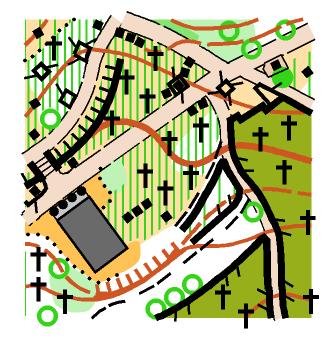
A cracking urban event incorporating the Victorian Cemetary, intricate housing estates and parkland in the area to the south west of Sheffield City Centre. Courses to suit all ages and levels of experience. This event is part of the YHOA Urban League.

Assembly: In the General Cemetery, off Montague Street. Toilets will be available.
Parking: On urban streets surrounding the Cemetery.
Starts: 10.30-12.30pm. There are 2 starts. Near start for White, Yellow & Orange at assembly. Far start for all other courses 500m. The route to the far start includes busy road crossings. Courses close 14.30.
Courses: (optimal route choice lengths in brackets)
White: 1.0km (1.4km)
Yellow: 1.2km (1.8km)
Orange: 2.1km (2.8km)
Short Green: 3.5km (5km)
Green: 4.6km (6.1km)
Blue: 5.5km (7.8km)
Brown: 6.6km (9.5km)
White and Yellow are contained within the walls of the General Cemetery. Orange includes some paths external to the Cemetery but involves no road crossings. White, Yellow & Orange are suitable for unaccompanied juniors. All other courses involve several crossings of roads including several quite busy routes. Under 16s must be accompanied by adults on Short Green and above. Please take care when crossing roads and use pedestrian crossings where possible. The area is open to the public including dog walkers, so please be polite and courteous and give way if necessary.
Participants wishing to count in the YHOA Urban League should enter the following courses:
Terrain:
Courses take in several local parks, housing estates and local streets offering a wide variety of challenges including complex route choices. All courses finish in the General Cemetery, which is a Victorian cemetery and nature reserve combining parkland with woodland and a complex path network. There are a large number of uncrossable features throughout which are FORBIDDEN TO CROSS.


Entries:
Please enter in advance to guarantee the map of your choice viahere. Closing Date 1/9/17. EOD subject to map availability in assembly 10am - 12 noon.
Adults: £10 (£8 BOF members) for Light Green to Brown, £4 White to Orange
Juniors / Full time students: £4
Families £24 (£20 members)
If you would like to go round in a pair or group you pay for 1 entry. Additional maps £1.
Key Officials:
Organiser: Bill Hanley.
Planner: Oli Johnson
Controller: Tim Tett.
Safety & risk
A comprehensive risk assessment will have been carried out by the organiser, but participants take part at their own risk and are responsible for their own safety during the event. If a competitor has a pre-existing medical condition that they think should be declared, please complete a medical form at enquiries. The sealed envelope will only be opened in an emergency.
Photography
SYO has an agreed policy on the taking of photographs at events, based on national guidance. This provides a sensible balance between the benefits and risks associated with the taking and use of images. If you are unsure about acceptable practice, please speak to the event organiser. Read our photography policy.
Privacy
When entering our events your personal details (name, gender, age class & club) will appear in the results section of this website. Read our privacy policy to see how we look after your personal data.
Venue
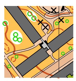
The Sheffield SW maps include the south-west part of the city centre and areas both side of Ecclesall Road (A625). For the 2014 sprint event the area was split with the prologue north of the A625 and the final south.
